Tropical Storm Chantal Develops Near South Carolina, Threatens Holiday Weekend
Tropical Storm Chantal emerged off the coast of South Carolina on Saturday morning, triggering Tropical Storm Warnings for various beach areas and signaling a turbulent finish to the holiday weekend.
As of now, Chantal boasts maximum winds of 40 mph and is located approximately 150 miles southeast of Charleston, South Carolina, moving northward at a mere 2 mph, according to the National Hurricane Center.
Forecasts indicate that the storm may gain some additional strength throughout Saturday, with landfall anticipated on the northern South Carolina coast by Sunday morning.
“The primary concern will be heavy rainfall, particularly where the storm center comes ashore north of Folly Beach late tonight or likely Sunday morning, possibly around dawn,” stated FOX Weather Storm Specialist Mike Seidel from Folly Beach. “It’s a broad system at this stage.”
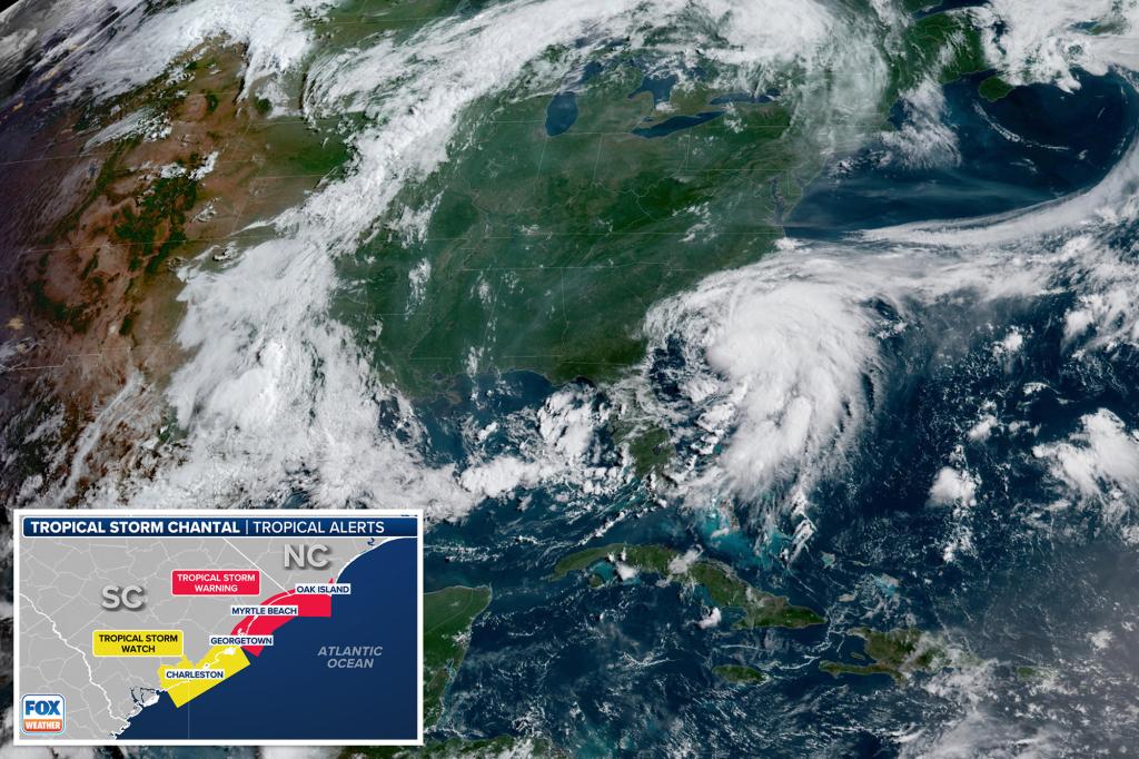
Tropical Storm Warnings are in effect from South Santee River in South Carolina to Cape Fear in North Carolina, while a Tropical Storm Watch has been issued for the area surrounding Edisto Beach to South Santee River.
Tropical storm-force winds are expected to impact the warning regions starting on Saturday evening and continuing into Sunday morning, with gusts of 40–45 mph likely in the watch areas later that day.
Seidel noted, “Even if we experience gusts of 40 to 45 mph, structural damage is unlikely, with minimal power outages expected.” He reiterated the significance of the rain, along with hazardous wave action and rip currents impacting South Carolina’s beaches, particularly towards Wrightsville.
Alongside these wind conditions, heavy rainfall is projected across the coastal plains of the Carolinas, with most areas expecting between 2 to 4 inches, and isolated locations potentially receiving up to 6 inches, according to the NHC.
Additionally, Chantal will generate minor storm surges along parts of the Carolinian coast.
“The combination of storm surge and tide could flood typically dry coastal areas, as waters move inland from the shoreline,” the NHC warned.
Peak surge levels could reach 1-3 feet in the areas under Tropical Storm Warnings, and 1-2 feet in the watch zone.
This scenario is paired with dangerous surf conditions and life-threatening rip currents for those along the beaches affected by Chantal.
The Atlantic hurricane season is in effect from June 1 through November 30.

Passionate journalist and digital news editor with a keen eye for global affairs and emerging trends. As the founder and lead writer of RSS News US, he is dedicated to delivering accurate, insightful, and engaging content to readers seeking trustworthy news in a fast-paced world.